MODEL COURSE
Morioka Station

Hachimantai Aspite Line

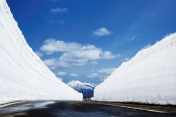
Aspite" is the name given to a volcano shaped like a shield lying face down. The 27-km driveway spans both Iwate and Akita prefectures and crosses the Hachimantai Mountains. The Hachimantai Aspite Line, which will be closed to winter traffic in mid-April, is a "snow corridor" with several meters of snow still remaining on both sides of the road. The snow corridor will be open to traffic from mid-April to November. The line is open to traffic from mid-April to early November. However, the road may be closed when there is a danger of freezing.
2024 Season】
Scheduled to open from 10:00 a.m. on Monday, April 15, 2024>
Please note that the schedule is subject to change depending on weather conditions.

Hachimantai

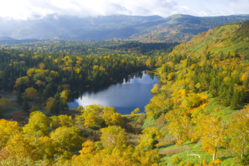
Hachimantai, a part of Towada-Hachimantai National Park, straddles both Iwate and Akita prefectures, and includes a plateau centered on the mountains that form the backbone of the Ou Mountains, Genta-Mori and Mt. Chausu to the east, and Mt. Hakudake and Fujishichi Onsen to the south. , is used as a general term that includes the western Minoyu and Yakeyama areas. It has an aspite-like topography, with numerous crater marshes such as Hachimanuma among the sea of Betula birch and Aomori fir, and alpine plants such as day lily and skunk cabbage spread out around the gentle walking path. Additionally, there are the Hachimantai Aspite Line and Hachimantai Jukai Line, which are great driving courses that allow you to fully enjoy nature while admiring the majestic view of Mt. Iwate, and there are parking lots and rest houses at the prefectural border.
Detailed Destination Information
Lake Towada

Oirase Stream

Shin-Aomori Station


